


Culbertson Precinct, Hitchcock County, Nebraska
About
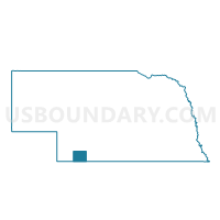
Outline

Summary
| Unique Area Identifier | 613262 |
| Name | Culbertson Precinct |
| County | Hitchcock County |
| State | Nebraska |
| Area (square miles) | 195.96 |
| Land Area (square miles) | 195.96 |
| Water Area (square miles) | 0.00 |
| % of Land Area | 100.00 |
| % of Water Area | 0.00 |
| Latitude of the Internal Point | 40.20014500 |
| Longtitude of the Internal Point | -100.84459730 |
Maps


Graphs
Select a template below for downloading or customizing gragh for Culbertson Precinct, Hitchcock County, Nebraska


Neighbors
Neighoring Voting District (by Name) Neighboring Voting District on the Map
- District 2 Precinct, Hayes County, NE
- Garden Prairie Precinct, Frontier County, NE
- Herl Township Voting District, Rawlins County, KS
- Northwest Precinct, Red Willow County, NE
- Palisade Precinct, Hitchcock County, NE
- Southwest Precinct, Red Willow County, NE
- Trenton Precinct, Hitchcock County, NE
Top 10 Neighboring County Subdivision (by Population) Neighboring County Subdivision on the Map
- Culbertson precinct, Hitchcock County, NE (800)
- Perry precinct, Red Willow County, NE (395)
- Herl township, Rawlins County, KS (310)
- Ridnour precinct, Hitchcock County, NE (218)
- Riverside precinct, Hitchcock County, NE (123)
- Driftwood precinct, Red Willow County, NE (95)
- Pleasant Hill precinct, Hitchcock County, NE (61)
- Blackwood precinct, Hitchcock County, NE (58)
- Logan precinct, Hitchcock County, NE (40)
- Grant precinct, Hitchcock County, NE (39)
Top 10 Neighboring Place (by Population) Neighboring Place on the Map
Top 10 Neighboring Unified School District (by Population) Neighboring Unified School District on the Map
- McCook Public Schools, NE (9,174)
- Rawlins County Unified School District 105, KS (2,108)
- Southwest Public Schools, NE (2,093)
- Hitchcock County School System, NE (1,915)
- Wauneta-Palisade Public Schools, NE (1,518)
- Medicine Valley Public Schools, NE (1,356)
- Hayes Center Public Schools, NE (677)
Top 10 Neighboring State Legislative District Lower Chamber (by Population) Neighboring State Legislative District Lower Chamber on the Map
Top 10 Neighboring State Legislative District Upper Chamber (by Population) Neighboring State Legislative District Upper Chamber on the Map
Top 10 Neighboring 111th Congressional District (by Population) Neighboring 111th Congressional District on the Map
Top 10 Neighboring Census Tract (by Population) Neighboring Census Tract on the Map
- Census Tract 9627, Hitchcock County, NE (2,908)
- Census Tract 9611, Frontier County, NE (2,756)
- Census Tract 9631, Red Willow County, NE (2,708)
- Census Tract 9506, Rawlins County, KS (2,519)
- Census Tract 9615, Hayes County, NE (967)